Shoshone Falls, though largely captured for most of the year to run turbines for power generation, does sometimes run wild in the spring, giving us a taste of what it once looked like. We can see the free-falling water at Mesa Falls anytime, since it is the last large, unfettered falls on the Snake River. One mystery is what one waterfall, now lost to time and the production of power, looked like.
Photos of American Falls prior to dam and power plant construction may exist, but I have yet to find one. There are several postcard photos showing the area of the falls shortly after the power plant and bridges were put in, giving some idea of what the original falls looked like. All that utilitarian construction is, charitably speaking, distracting.
Perhaps there is no photo, but there is a lithograph of American Falls, (Idaho version, not to be confused with Niagara). It is from a sketch by Charles Preuss and appeared in John Charles Fremont’s first report to congress on his western explorations. Preuss was the cartographer for the expedition. His 1843 sketch of the falls is one of the earliest depictions of what is now Eastern Idaho.
The sketch shows a dramatic drop of water, split by a rock island. But one must take the accuracy with a grain of salt. As stated in the book One Hundred Years of Idaho Art, 1850-1950, by Sandy Harthorn and Kathleen Bettis, “Because Preuss was trained as a cartographer and not an artist, we can accept that his rather naïve drawings outline the land features rather than describe them as solid forms. Drawn in a stiff awkward manner, this deep vista appears exaggerated and fanciful. The river drops from a flattened plain over the edge of an angulated precipice more illusory than real.”
Perhaps the reason photos of the falls before they were captured are difficult to come by is that they simply weren’t picturesque enough to attract a photographer.
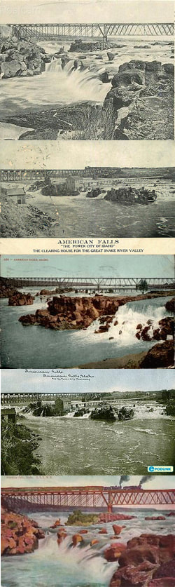
Many postcards depicting American Falls before the dam exist, but they also include a lot manmade structures spoiling a clean view of the falls.
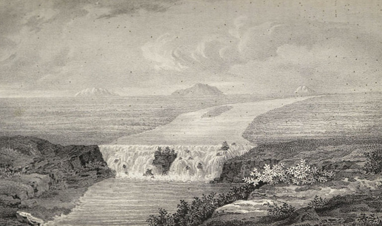
This depiction of the American Falls is by Charles Preuss and appeared in John Charles Fremont’s first report to congress on his western explorations. It is likely a bit fanciful.


 RSS Feed