Today, I’d like your help in solving one of the enduring mysteries of life. At least, it’s an enduring mystery if you grew up in and around Firth. Shelley and Blackfoot, north and south of Firth, made US 91 their main street in the early days. The highway passes through Firth, too, but Firth’s Main Street is parallel to US 91, as if someone shoved the business district back away from the highway 50 feet. Over the years this has caused no end of confusion for people new to the town. For much of its history “Main Street” resembled a big, unstriped parking lot. People weren’t quite sure where they were supposed to be. It was terrific for cutting cookies in the winter when the whole thing froze over. Note to self: Watch out for the Texaco station.
This picture, courtesy of the Mike Fritz collection, shows Firth in the 1920s. South is at the top of the picture, more or less, as the highway runs north/south. Maybe there’s a clue here. You can see 91 paralleling the railroad tracks, then taking a little jog to allow for the train depot. On the right-hand side of the highway—west—you can see the utility lines punching through town. Those lines would have had a right of way. You can see the beginnings of Main Street to the right of those lines, like a frontage road. I’m wondering if the town and frontage road developed in a way that would avoid messing with those lines. Years later, maybe the lines went away and the town paved the abandoned right of way between Main and the highway.
I’d love to hear other theories, or better yet an explanation from someone with secondhand knowledge. First handers, sadly, would all be dead.
Can you identify any of the buildings in the picture below. I recognize the old train station, now gone. There is an elevator where the Firth Mill and Elevator is still, though it may have changed. The only building I can identify that is still in existence is the Corgatelli Building, almost in the center of the photo. Firth residents today would call it Collet's Bar. It was built sometime before 1913.
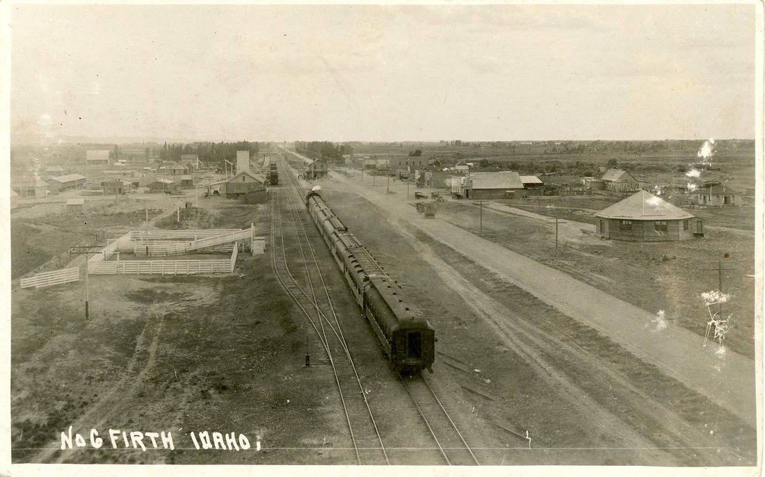
This photo of Firth circa 1920 is from the Mike Fritz collection.


 RSS Feed